
Our Solutions
Next-Level Interactive Experiences
Engage users like never before with outstanding user experiences in the most intuitive way possible with our multi-touch applications, augmented reality, and virtual reality technology.
Upgrade to a Truly Digital Workplace
Leverage the power of award-winning Microsoft Power Platform, Microsoft SharePoint intranets and portals to collaborate, streamline, communicate, and manage data like never before.
Workplace Analytics
Unleash your most powerful dataset. Transform your business using insights from everyday work in Office 365. Increase employee focus and create value.
Reach the Cloud
Upgrade to a cloud-hosted infrastructure for unparalleled storage, access, and productivity solutions - all while enjoying cost savings and scalability.
Science & Design
Enterprise data solutions that collect, store, and analyze data in real time, allowing you to quickly access important information to make the most informed business decisions.
Custom IT Managed Services
Comprehensive, transparent managed IT services tailored to the specific needs of your business that reduce costs and increase efficiencies and security.
A Truly Digital Workplace

Create
Spark creativity, enhance productivity, and easily collaborate with team members to develop concepts and guidelines with quick access to past digital assets and asset analytics.

Innovate
We are a diverse group of innovators with expertise on Microsoft technology. our custom-built app can help to reinvent your business with enhance profitability index.

Distribute
Streamline distribution and utilize roles and permissions to provide the right people with access to digital assets in various formats, complete with links and embed codes.

Preserve
Safely preserve and archive valuable digital assets that have reached the end of the lifecycle with an accessible, cost-effective archive storage solution.


We are proud to show numbers

1005895
Lines of Code

22000
Apps Downloads

200+
Amazing Products

2000+
Delighted Customer
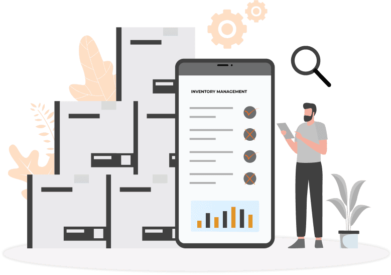
Personal Protective Equipment - Inventory Management
Personal protective equipment (PPE) is used every day by healthcare personnel (HCP) to protect themselves, patients, and others when providing care. PPE helps protect HCP from potentially infectious patients and materials, toxic medications, and other potentially dangerous substances used in healthcare delivery.
Our Customers


Product Spotlight
Office 365 Timesheet App
Maximize your SharePoint collaboration features, accurately track the amount of time employees spend on the job, and enjoy enhanced management capabilities with our proprietary Office 365 timesheet app.


Online Permit Portal
Our online permit portal is ideal fit for townships and municipalities, and is highly customizable to accommodate any kind of permission including road opening permit, planning and zoning permit, building permit and tree removal permit etc.
Vendor Management System
Our customizable vendor management solutions help you organize contracts and vendor information, collaborate with other team members on compliance tasks, analyze vendor risks and costs, and stay up-to-date on vendor performance.


IT Change Management
Keep your team members informed of any changes in your IT infrastructure. Inform them about outages in advance and collaborate better
Client Testimonials
Ignatiuz has consistently been a partner in our overall internet presence. Over the years Ignatiuz has provided guidance with their leading edge skills and expertise. Simply stated Ignatiuz is a solution provider for our web development and web facing security needs.
Working with Ignatiuz is a pleasure – they are very smart and always keen to help us figure out how to simplify the most complex problems into usable solutions. They has been our offshore development team for the past 4 years, and we see them as a partner (rather than vendor). They are always ready to put the extra effort to help hit deadlines, and as Gina (head of solutions delivery) puts it: “It’s like magic – we give them the work, and the next morning it is complete and all there. Wonderful!
We are a small/medium sized healthcare organization. We have been working with Ignatiuz since December 2009. They developed a custom SharePoint solution for us, including custom views, webparts, and connectors to outside SQL databases. Since then, they have also taken on an active role of server administration for our organization. Over the last two years, there has been around a half dozen instances where an issue has come up that needed immediate attention, and each time Ignatiuz responded in a timely and professional manor, completely addressing and fixing the issue within a very short period of time.
I would truly call team Ignatiuz as Kings of SharePoint. They are highly experienced and know each and every nerve of SharePoint. All my requirements from SharePoint installation to development and deployment to testing were served in time and with 100% quality. Wish you a good luck guys.
Ignatiuz team has been an absolute joy to work with. They are very pleasant, courteous and knowledgeable. They have been punctual to tasks scheduled and handled migration process very efficiently. We look forward to continue working with team Ignatiuz.